View Wilshire Center in a larger map. The Wilshire Center district boundaries are shown in purple.
Click here to view the Wilshire Blvd interactive website that provides photos and information on various historical buildings along Wilshire Blvd (sponsored by the LA Conservancy).
Take a walking tour of Wilshire Center's history and historical buildings by way of Wilshire Angels Walk LA (download guidebook and map).
Click here to view the Wilshire Center B.I.D. Boundary Map (pdf).
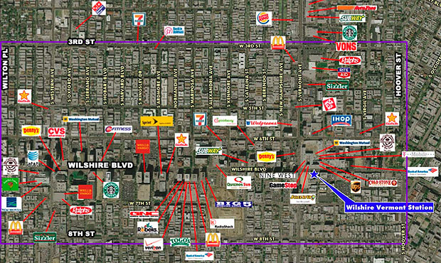
Below is a low resolution Retial Map of the area.The Wilshire Center district boundaries are shown in purple.
We are currently working on a higher resolution version of this map which is due to be released soon.
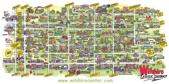
WCBIC has once again produced a map of our area. The front side is a full of color, "fun guide," and the backside tells the Wilshire Center urban village story. We have come a long way over the years; the present is good and the future is bright. Copies of the map are available at the WCBIC office and on our web site (below).
The area for the map is located between 3rd and 8th from Wilton Place to Hoover Street and is approximately 2 square miles. This area is home to about 1,500 retail businesses and over 100,000 residents, and employs over 80,000 people and hosts thousands of visitors. Use the links below to view the PDF's.
Click Here To Download Map Front Side PDF
Click Here To Download Map Back Side PDF
 |